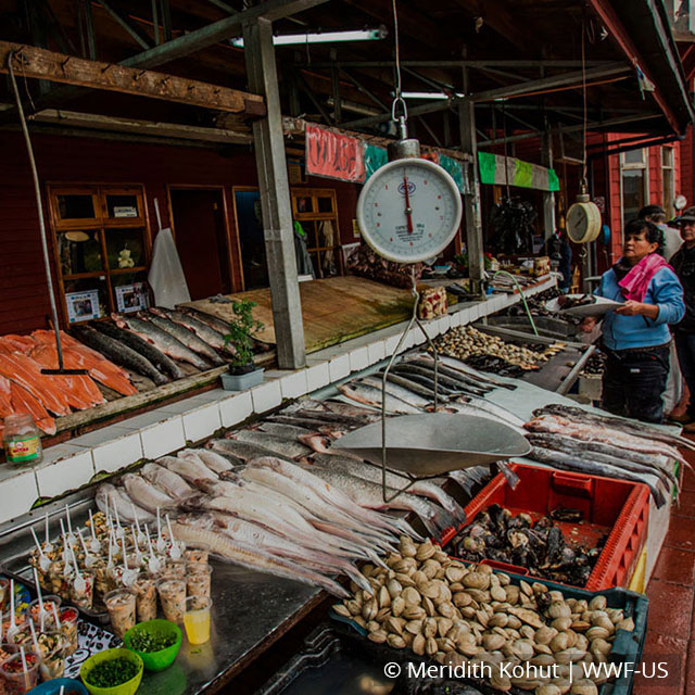

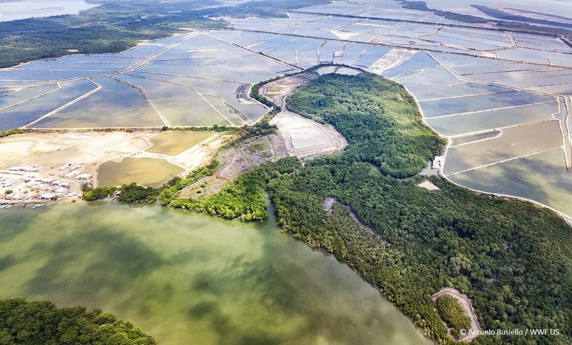
Seafood buyers are increasingly looking for ways to understand and reduce the environmental risks in their supply chains, notably in shrimp aquaculture. A new Coastal Habitat Mapping Tool by Clark Labs provides insights regarding habitat conversion which might answer that. Combining high quality satellite imagery and expert geospatial analysis, Clark Labs’ aquaculture mapping tool offers a look at historical landscape changes for critical wetlands habitats, including mangroves, and aquaculture pond cover in major shrimp exporting countries around the world.
When combined with supply chain traceability data such as a source farm’s geographic coordinates, the Coastal Habitat Mapping tool can help companies confirm whether their farmed shrimp product may have contributed to wetland or mangrove habitat losses. The tool operates at a detailed resolution of 15meters using satellite imagery from Landsat 8 and 5.
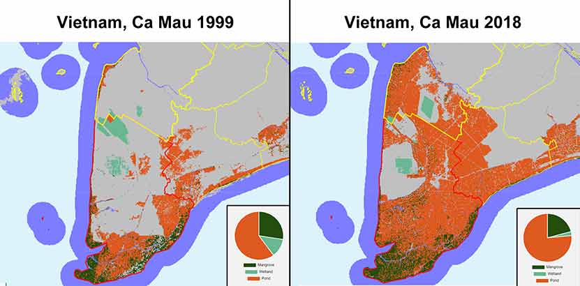
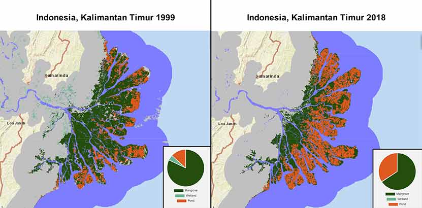
The current data covers the period from 1999 to 2018 and includes key farmed shrimp production countries like Thailand, Vietnam, Indonesia, India, Ecuador, Myanmar, Bangladesh, Cambodia. The online mapper is publicly available free of charge for non-commercial use and can be utilized to explore Clark Labs’ data in many ways, such as cross-checking farm locations for historical habitat loss, and assessing vulnerability of new areas to deforestation and conversion.
By mapping pond aquaculture and coastal habitats in key shrimp production countries at this resolution and across multiple years, our team is building data that can be used in a number of ways, including by seafood buyers wanting to explore the risks of ecosystem conversion associated with their shrimp suppliers.
J. Ronald Eastman, Director of Clark Labs and Professor Emeritus at the Graduate School of Geography at Clark University.
WWF has been collaborating with Clark Labs on the use and dissemination of the free mapping tool and datasets to help advance aquaculture conservation with its partners. By harnessing the potential of extensive satellite imagery data, these tools can help drive accountability and transparency on ecosystem conversion risks throughout the value chain.
The data goes back to 1999, a year generally recognized by the aquaculture sector as the cut-off date after which no mangrove and habitat conversion for shrimp ponds should occur. Having a clearly defined cut-off date as well as a monitoring and verification system are key elements of a credible conversion and deforestation-free commitment as defined by the Accountability Framework Initiative (AFi), a coalition of NGOs seeking to champion consistency and credible progress around these types of commitments. The Aquaculture Stewardship Council (ASC) shrimp standard, a leading global certification for responsible shrimp aquaculture, also uses 1999 as a cut-off date for conversion of mangroves and other wetlands.
Clark Labs has done an excellent job of mapping the coastal habitat of major shrimp producing countries at a high resolution and over a critical period of time. The data can be used in many ways, including practical applications of understanding risks of habitat conversion in shrimp supply chains. The data is publicly available, and we hope that in the future users will be able to access and utilize this data in additional tools as well, making c-free shrimp production a reality around the world.
Merrielle Macleod, Lead Aquaculture Specialist at WWF.
In addition to making their online mapping tool publicly available, all Clark Labs data, including historical land cover and vulnerability index datasets, are accessible for free download. This includes Clark Lab’s present day “Risk of Land Conversion to Pond Aquaculture”. These layers express the probability of conversion to pond aquaculture for countries like Thailand, Cambodia, and Vietnam and are based on an empirical weight-of-evidence approach that incorporates multiple factors such as proximity to existing conversion, land suitability and access to transportation.
This initiative, developed in partnership with the Gordon and Betty Moore Foundation and in support of the Foundation’s Oceans and Seafood Markets Initiative, will continue to update data layers with landscape changes in the geographies already mapped, and will expand coverage to other geographies including China, Brazil, Honduras, El Salvador, Nicaragua, Philippines, and Mexico through 2021 and 2022, providing companies with additional supply chain transparency and further building on its use as risk monitoring tool.
To learn more about conversion risks in farmed shrimp supply chains and this tool, sign up here for our upcoming free webinar.